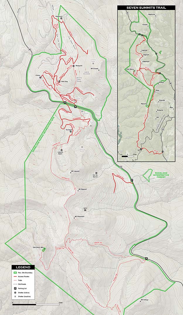


WELCOME!The Rossland Range Recreation Site is a free public use area in the high mountains and rolling hills near Rossland, BC, Canada. Strawberry Pass Summit and the primary parking area is located about 19 km north of Rossland on Highway 3, or about 8 km south of the intersection of Highways 3 and 3B. (Printable versions of the North and South portion of the below map are on the Before You Go ( MAPS and Commercial Use) page.)The Rec Site is operated and managed by an all volunteer organization, Friends of the Rossland Range (see details below).
The area has a network of winter routes and a chain of unique, winter, day-use cabins for all ages and families who would enjoy self-guided snowshoeing, cross-country skiing or backcountry ski touring. The unique day-use cabins are a fine destination to plan to visit, offering warmth and shelter from the weather or a break with lunch or a warm drink. Some of the day-use cabins are very near and easily accessible from the trailhead, others are further away and can provide a more challenging adventure. Dogs are allowed on the winter trails, which are not "groomed".In summer, there is hiking, mountain biking, watching wildlife, walking a dog or taking a horseback ride, all using summer trails in the Recreation Site and around Rossland including those on maps by the Kootenay Columbia Trails Society .Only a short drive from Rossland, the excursion you plan in this area could be from 1/2 hour to up to 1 1/2 hour, an easy route or a more difficult route, it's up to you to decide. The area is about an hour of highway driving from Nelson and Grand Forks, BC.Everyone is welcome - all ages, groups, abilities, visitors, locals.The combination of high country from Mt. Kirkup to Mt. Crowe, varied terrain, easy access, and long history and tradition make this area a unique recreational area treasured by locals and visitors. Because this area is so special, the community worked together to achieve Recreation Site status for the area. Community volunteers can now build on what has been done in the past, with security for projects and funding to maintain this very special place.The Friends of the Rossland Range is the community’s official entity for managing the Rec Site under a legally-binding Partnership Agreement with the Ministry of Forests Recreation Sites and Trails Branch. (In a nutshell, government creates an official Recreation Site, but the community does all the work, including raising most of the funds.) We've dedicated the Management Plan page to these important agreements.HAVE FUN!It’s your Recreation Site! |